

LiDAR survey proposed for a more detailed assessment of NW-101 corridor
The Tizu–Zungki National Waterway is set for another technical assessment, with Chief Minister Neiphiu Rio stating that a LiDAR survey has been proposed for a more detailed assessment of the waterway corridor.
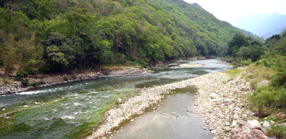
The proposal comes after the waterway had already undergone a Stage-I feasibility study, a Detailed Project Report (DPR) and a hydrographic survey in 2024. The final report of the hydrographic survey conducted in October 2024, however, is still listed as awaited in the Nagaland State Transport Department’s project status.
At the same time, the DPR commissioned by the Inland Waterways Authority of India (IWAI) in 2020 had already examined the navigability, infrastructure requirements, projected traffic and financial viability of the Tizu–Zungki waterway.
The DPR assessed the river as having “very limited potential for its development for Inland Water Transport (IWT) operation” and found that its most ambitious proposed phase was not viable based on projected traffic.
Rio’s statement, made on August 15, therefore places the project at another assessment point nearly a decade after Tizu–Zungki was notified as National Waterway-101.
READ | Four airstrips and waterways planned as Nagaland looks to improve connectivity
Tizu–Zungki was notified as NW-101 through Gazette Notification No. 18 dated March 26, 2016, according to a subsequent statement made by the State government in the Nagaland Legislative Assembly.
By 2018, a Stage-I feasibility study of the waterway had been completed. IWAI subsequently commissioned WAPCOS to prepare a DPR for development of the Longmatra–Avangkhu stretch, with the final report completed in January 2020.
What the 2020 DPR found
The 2020 DPR did not present Tizu–Zungki as a straightforward commercially viable inland waterway.
The report examined the river’s navigability, fairway development, dredging requirements, terminal infrastructure, projected passenger and cargo traffic and the financial viability of the proposed project.
For the proposed development, terminal locations were identified at Longmatra, Laruri Bridge, Pokhungri and Avangkhu.
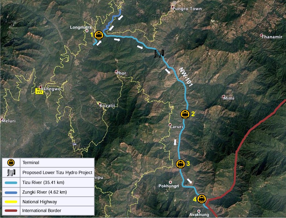
For the initial phases, the report considered relatively limited passenger and cargo operations. Its Phase-II projections included around 61,632 local passengers and 9,413 tourists annually, besides approximately 587 tonnes of household commodity traffic.
In its conclusion, the DPR stated that the river had “very limited potential for its development for Inland Water Transport (IWT) operation.”
The physical requirements for navigation were also substantial. For a Class-I channel with a depth of 1.2 metres and a bottom width of 30 metres, the DPR estimated around 2.14 lakh cubic metres of dredging. It described the dredging requirement as very high for the river stretch under consideration.
The report also considered a smaller channel with a depth of one metre and a bottom width of 15 metres. Under that option, the river was considered navigable from Longmatra to Avangkhu without extensive dredging, although underwater stones would have to be removed.
The financial assessment was more direct.
The DPR stated that large investment would be required for construction, maintenance and overheads associated with the terminal. It attributed the high expected capital and operational costs to the lack of traffic and underdevelopment in the region, and concluded that “the project would not be financially profitable.”
The DPR separately examined a more ambitious Phase III involving substantially higher industrial cargo traffic and an estimated investment of more than Rs 981 crore.
That phase was also assessed as not viable considering the projected traffic potential and was not recommended for development.
The report, however, did not entirely dismiss the strategic potential of the waterway.
It noted that, in the future, the waterway could potentially provide connectivity through inland water transport between India and Myanmar up to Thamanthi in Myanmar.
The DPR also recognised that its assessment could change with circumstances.
In its concluding remarks, the report stated that it “can be updated at a later stage when required”, taking into account fresh cargo analysis, changes in the requirements of the government, or changes in the policy of either the State or Government of India.
Six years after the DPR was completed, the State is now proposing a LiDAR survey for a more detailed assessment of the Tizu–Zungki corridor, following a separate hydrographic survey in 2024.
The government has not publicly clarified whether the proposed LiDAR exercise is intended to form part of an update to the 2020 DPR, or whether a revised DPR will be prepared after the new assessment. LiDAR, or Light Detection and Ranging, is a surveying technology that can be used to map terrain and other physical features in detail.
Despite the completion of the DPR, implementation was still being pursued by the State in 2021.
In November that year, the State government told the Nagaland Legislative Assembly that the project was proposed to be implemented in phases through the Nagaland Inland Waterways Board (NIWB).
The government also stated that it was pursuing the matter with the Centre and seeking support to begin Phase I.
The Assembly record noted that the then Union Minister for Ports, Shipping and Waterways had indicated that the project could be taken up after Nagaland submitted a prioritised proposal for its commencement.
However, MT could not find publicly available documents or records establishing the subsequent status of implementation.
In 2023, representatives of the Longmatra Area GBs Association also appealed for prompt implementation of inland waterway connectivity from Longmatra to Avangkhu during the inauguration of the Zinki Bailey Bridge.
The project returned to the government’s agenda in 2024, when another feasibility assessment was announced for NW-101.
The proposed assessment was to cover fairway development, navigational aids, terminals, minimum infrastructure, skill development and vessel procurement for cargo and passenger transportation.
A joint hydrographic survey was conducted by IWAI’s Guwahati regional office and the Nagaland State Transport Department from October 25 to 30, 2024.
The final report of that survey is still awaited.
Rio has now stated that a LiDAR survey has been proposed for a more detailed assessment of the waterway corridor.
It is not yet clear how the proposed LiDAR survey will build on the earlier assessments, including the 2024 hydrographic survey whose final report is still awaited, or whether it will ultimately lead to an updated DPR.