

Repeated landslides, sinking roads and difficult geological conditions raise questions over the role of geoscientific studies in infrastructure planning
In recent years, Nagaland has been witnessing major infrastructure development, with roads, railways and urban projects being taken up across its difficult hill terrain.
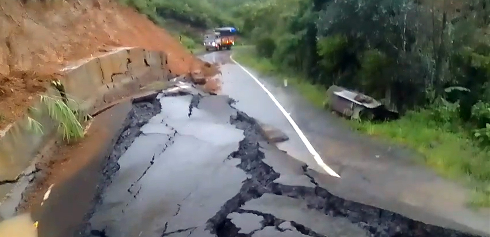
At the same time, the state continues to face landslides, slope failures and land sinking, particularly during the monsoon.
This raises a basic question: how much is known about the ground before construction begins?
The Nagaland Department of Geology & Mining states that geological parameters and rock and soil mechanics need to be considered before construction. Its geotechnical section undertakes investigations relating to buildings, roads, bridges and dams. The department also notes that Nagaland falls under Zone V for seismic and landslide hazards.
The department’s Geosciences section has documented numerous palaeoslides and active landslides in the state and stressed the importance of site-specific investigations to understand surface and subsurface conditions.
NH-29 offers one example of why such studies matter.
The Geological Survey of India carried out a post-disaster investigation following a landslide between Chumoukedima and Ghaspani in September 2021. Scientific studies of the Kevüza area have also examined major landslides along NH-29, pointing to highly jointed and fractured rock formations, faults, groundwater and heavy rainfall among the factors associated with slope failure.
The Department of Geology & Mining has also undertaken landslide hazard zonation along the Dimapur-Kohima stretch.
Yet landslides have continued to disrupt the highway, including major incidents in 2024 and 2025, while authorities have again warned of rockfall and landslide risks this year.
The repeated incidents do not by themselves establish that geological investigations were not carried out during the planning or construction of the highway. They do, however, show why geological information is important when deciding road alignment, slope cutting, drainage and protection measures.
NH-702D provides another example.
Sections of the highway between Mokokchung and Mariani have experienced land-sinking and landslide problems. A 2020-21 report of the Department of Geology & Mining records investigations along the corridor, including road sinking and subsidence at Changki, Chungtia and Mekuli.
Mokokchung Times also reported in 2023 that geologists were investigating critical sinking areas along NH-702D through geological studies, topographical surveys, borehole drilling and geomorphology mapping.

Such investigations look beyond visible cracks or settlement to examine soil, rock structure, groundwater and other conditions below the surface.
The Dimapur-Kohima railway project provides perhaps the clearest current example of how geological conditions can affect major infrastructure.
At a review meeting in June 2026, the Nagaland government said the project was facing difficult geological conditions, landslide-prone terrain and poor rock quality. High-pressure groundwater ingress and fault zones encountered during tunnelling were also reported.
A technical study published in the Journal of Scientific & Industrial Research has separately examined the geotechnical design and rock-support requirements of a Dimapur-Kohima railway tunnel.
These conditions can directly affect excavation, rock support and groundwater management during construction.
Nagaland has been carrying out geological investigations for years. The Department of Geology & Mining has undertaken geological and landslide-related investigations at several vulnerable locations, including NH-29 and NH-702D.
A recent report by The Morung Express also highlighted concerns raised by experts that broad landslide-susceptibility mapping may not always provide the level of detail required for individual road and building projects.
A broad hazard map can identify vulnerable areas, but a particular road cut, foundation or retaining structure may require detailed, site-specific investigation.
Nagaland cannot avoid difficult terrain. Roads have to cross hills, tunnels have to pass through mountains and towns have to expand.
But as infrastructure development continues, the question is whether the geological information already available is being adequately considered at the planning and design stage of individual projects, and whether investigations are sufficiently detailed for each site.
Understanding the ground before construction may not prevent every failure. But it can help identify vulnerable locations and inform decisions on alignment, slope cutting, drainage, foundations and other protective measures.
(Sources referred to: Nagaland Department of Geology & Mining; Geological Survey of India; Nagaland government/IPR; Nagaland Basic Facts 2025; Journal of Scientific & Industrial Research; The Morung Express; Mokokchung Times; and published studies on NH-29 and Kohima landslides.)